DRONE SERVICES
Saving Time — Better Results
Saving Time — Better Results
Capture detailed aerial data, reduce time on site, and make informed decisions with confidence.
Reduce the need for lengthy site visits, manual measurements, and expensive access equipment. Drone surveys gather comprehensive data quickly, helping projects stay on schedule and within budget.
Capture precise aerial imagery, measurements, and models that support planning, analysis, and reporting. Reliable data leads to better decisions and fewer costly errors.
Inspect hard-to-reach or hazardous areas without putting personnel at risk. Drones provide detailed visual information while minimising the need for working at height or entering dangerous environments.
Accurate aerial data solutions for planning, monitoring, inspection, and reporting.
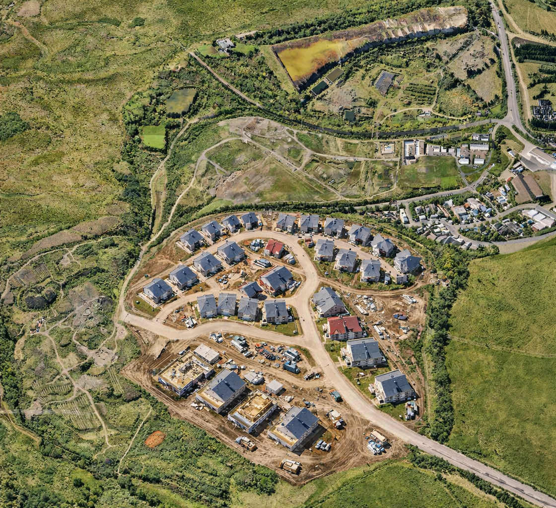
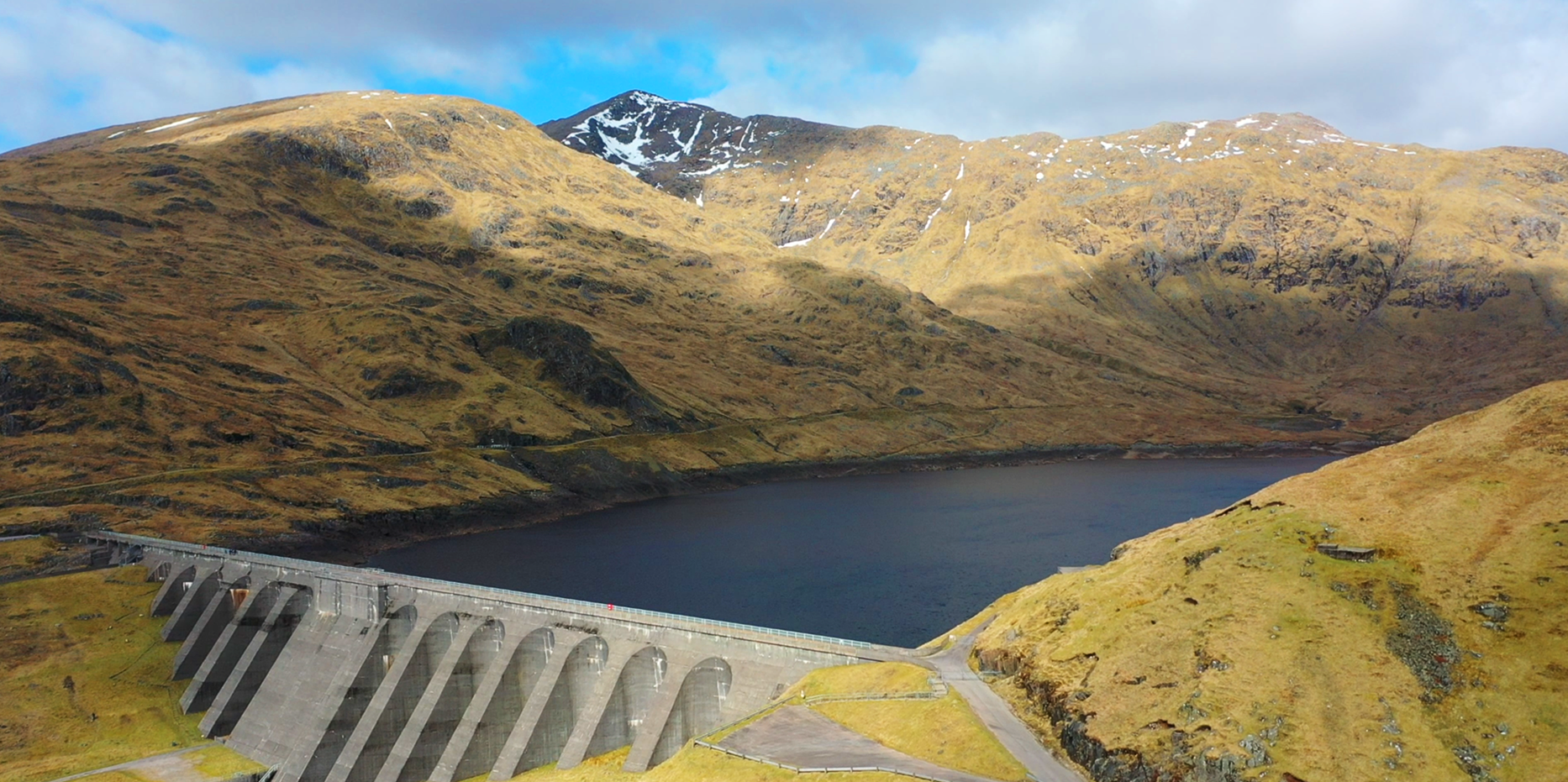
Create high-resolution orthomosaic maps that provide an accurate, up-to-date view of your site. Ideal for planning, progress tracking, land management, and project documentation.
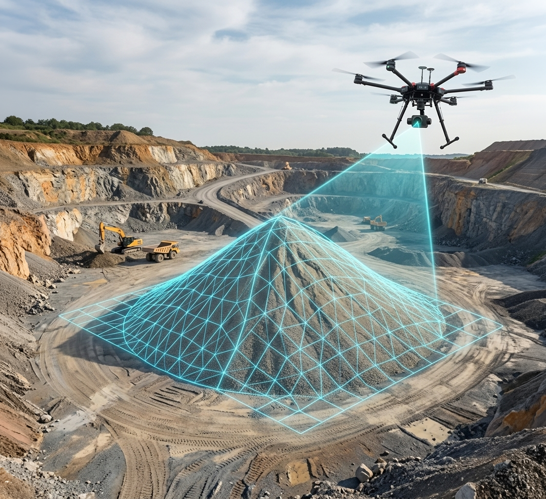
Generate detailed digital models of buildings, infrastructure, landscapes, and construction sites. Visualise projects from every angle and support analysis with precise spatial data.
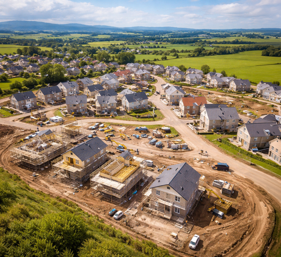
Collect comprehensive aerial survey data quickly and efficiently. Suitable for construction, land development, environmental monitoring, and asset management projects.
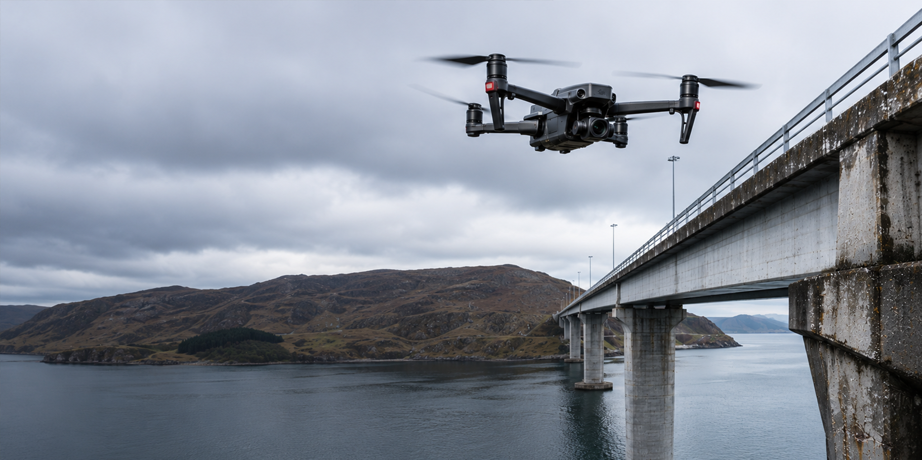
Inspect roofs, buildings, solar installations, towers, bridges, and other assets safely and efficiently. High-resolution imagery identifies issues without the need for scaffolding or specialist access equipment.
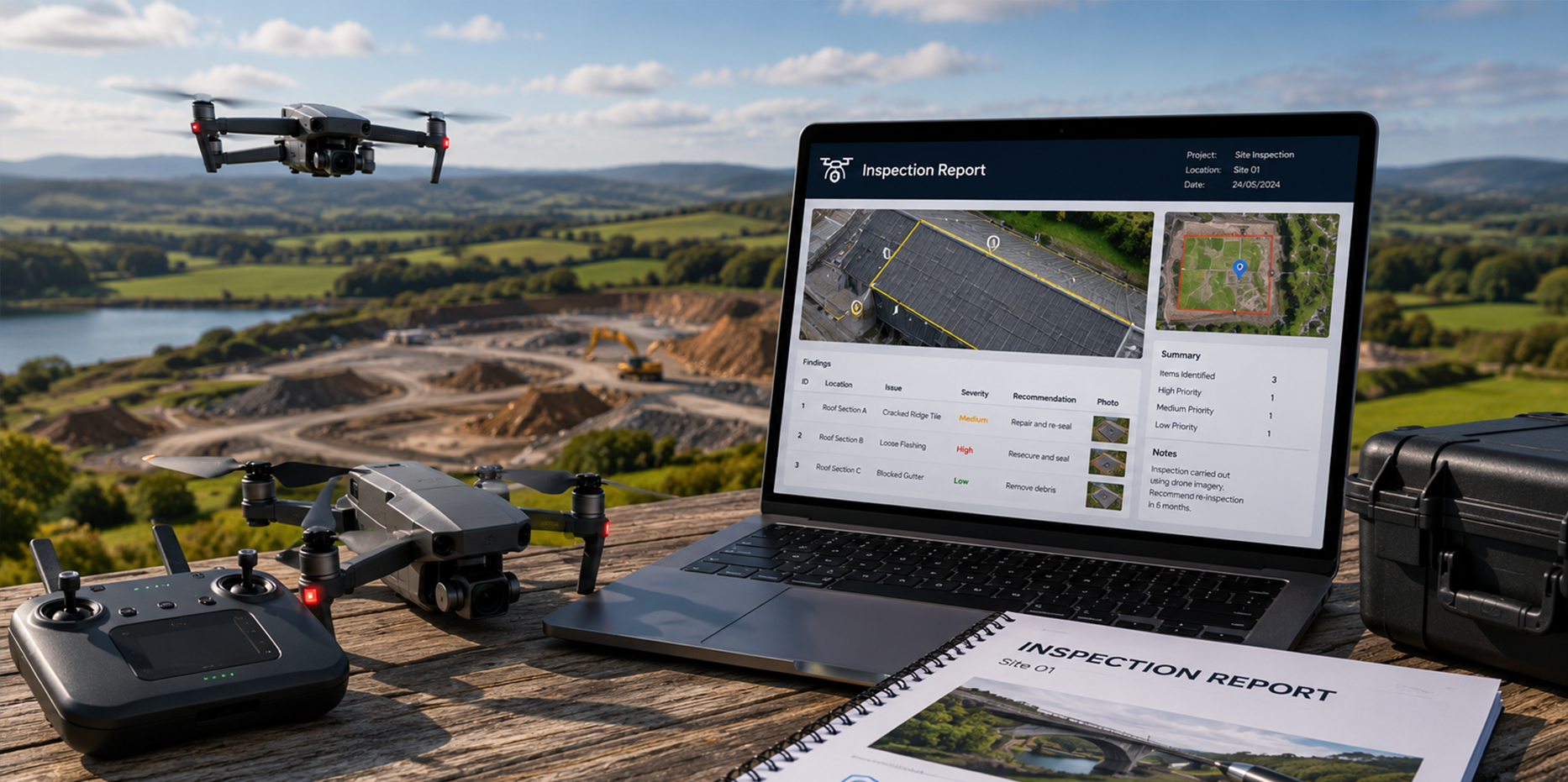
Receive clear, professional reports highlighting observations, defects, and recommended actions. Reports are tailored to your requirements and designed to support maintenance and compliance processes.
Create cinematic aerial footage that brings your site to life. High-quality drone video provides engaging visual content for project updates, marketing materials, stakeholder presentations, and digital media.